
")

In 2021, Ukraine was one of the world’s largest producers of critical crops. It supplied 15% of all corn in the global market and 10% of all wheat. But since Russia’s invasion in February 2022, Ukraine’s crop output has plummeted.
New, high-resolution satellite images reveal just how much has been lost: One occupied city has seen 20% of its wheat yield reduced, according to an analysis published this month in Environmental Research Letters. The root cause, the scientists say, is farmers abandoning their land—a situation that may be playing out in other war-torn regions across the globe.
The new study emphasizes the “critical impact of conflict” on farming in Ukraine, says Jonathan Bridge, a geoscientist at Sheffield Hallam University who was not involved in the work.
Previous research has provided some sense of Ukrainian crop losses and global food security concerns from the invasion. A study published in Nature Communications Earth & Environment in June, for example, found that the average wheat, sunflower, and rapeseed production in cultivated areas of war-torn regions in the country declined by about 37% in 2022 compared with prewar levels. But it was unclear how much of this was due to the war itself and what on-the-ground factors led to crop loss.
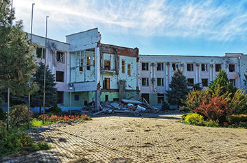
So, in the new study, scientists focused on Kherson, a front-line city they think is a model for other conflict-ridden regions in Ukraine. Before the invasion, the city had about 280,000 inhabitants; after it, there were only 80,000.
Russia’s invasion was an event that “deeply affected many of us in Europe,” says study author Simon Gascoin, a hydrologist at CNRS, France’s national research agency. Two of the team members, Veronika Antonenko and Iuliia Danylenko, were Ukrainians who had taken refuge in France because of the crisis.
The team compared satellite images of the fields in Kherson with the unaffected city of Poltava, about 300 kilometers away. The European Space Agency’s Copernicus program, a suite of Earth-observing satellites, provided the images. The team looked at data from three grain crop seasons: 2020 and 2021, before the invasion, and 2022, after it.
The researchers fed the satellite images into software that removed the effects of atmospheric vapor, aerosols, and clouds so the land areas became clearer. Then, they classified the images by land and crop type. Finally, they used a computer model called AgriCarbon-EO, which incorporates crop information, such as plant growth stage and how crops use carbon dioxide and moisture, to estimate how much plant matter sat above ground.
The model, which provided the first detailed estimates about affected wheat fields in any city in Ukraine, revealed that the wheat in Kherson fell from 9.7 tons per hectare before the invasion to 7.8 tons per hectare after it—a drop of about 20%. That represents a total loss of about 400,000 tons of grain—about the weight of four fully loaded aircraft carriers. By contrast, the amount of wheat in the Poltava region remained roughly the same over the 3 years.
Furthermore, whereas crops grew consistently over time in Poltava, they became more sporadic in Kherson. The reason has to do with fertilizers, which are applied to struggling fields at a key moment in their growing season, explains study author Ahmad Al Bitar, an earth scientist at France’s Center for Space Studies of the Biosphere. As farmers fled the fields or lost access to them, they became unable to apply fertilizers, meaning struggling crops suffered even more than normal, adds Antonenko, a remote sensing expert at the center.
After accounting for several factors, including weather and climate across the years, the team concludes that a lack of consistent fertilizer and irrigation due to farmers abandoning their fields were the biggest drivers of grain loss. The researchers suggest pollution and danger from land mines and military fortifications, as well as the destruction of farming infrastructure, may have also played roles.
Bridge says the findings are consistent with his agricultural research on conflict-ridden zones in northwestern Syria. Vasyl Cherlinka, a soil scientist from satellite imagery analytics company EOS Data Analytics, also agrees with the main results but says there is a main limitation to the study: The plant models could not be tested on the ground in Ukraine because of the conflict, a typical setback of research on war zones.
The researchers suggest their experiments could help researchers understand the impact of war on farming in other frontline regions, such as the eastern Mediterranean war zone of Lebanon.
As for Ukraine, the U.S. Department of Agriculture predicts lower grain yields because of the ongoing war, while the Ukrainian Grain Association also expects patterns of warm weather and low rainfall to harm crop growth. Total Ukrainian wheat production is expected to reach a maximum of 23 million tons in the 2024–25 season, still significantly lower than the 33 million tons per year produced before the invasion began.
More: https://www.science.org/content/article/satellite-images-reveal-massive-crop-losses-war-torn-ukraine